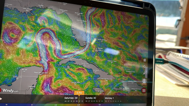
Our trip was slow and uneventful, despite the stress of Hurricane Beryl strengthening and whose path we would have to cross.
The Gulf Stream current played havoc with us and dogged us with 3-4 knots against us from Key West to the West end of Cuba. Two days of very slow sailing.
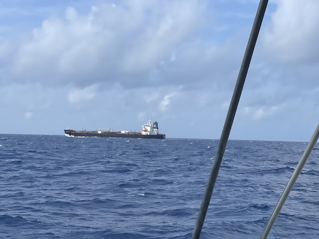
A Tanker who was on a Collision Course with us, crossing in front of us within a mile. Our new VHF/AIS aerial sees AIS Targets at a 25 mile range, and so we were well aware of the impending situation. The Tanker communicated with us on VHF to arrange passing, and we agreed to change our course to avoid a collision and pass behind them.
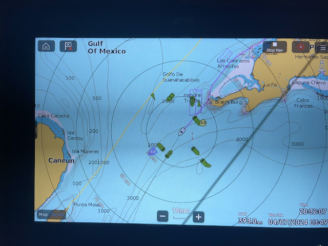
Then we had to cross the Gulf Stream again to the Mexico coastline, this time with the winds East we were able to head more SW across the Gulf Stream and close the Mexico coast south of Isla Cozumel which kept us out of the stronger current near Ilsa Mejures, which we had to contend with on the same trip last year when we had strong SE winds and could not head as south as we could now.
Thereafter we sailed south within 1-2 miles off the Mexican coastal reefs to keep out of the north setting Gulf Current, but the current and east winds created swells big enough to make sailing uncomfortable.
Nicholas studying the Chart and Instruments
The slower night speed meant we missed the High Tide for the Rio Dulce river bar, but we decided we’d try enter anyway, as we had a Track from our last exit, which was a published Track that a Cruiser had posted after depth sounding the bar. If we got stuck, we’d have to sit and wait for the next High Tide.
We crossed 4 hours after High Tide, and at a very low speed, with all sails down to motor and control our course exactly as the route included a dogleg. We touched briefly in soft sand and could feel the keels dragging through the mud, but we had no problem getting over the hard rock bar.
Our route over the River Bar, you can see the Dog Leg we have to make to avoid a very shallow patch, and the Track is no where near the Navionics Chart recommended Track!
Safely anchored in the Livingston anchorage area, a Ferry Boat approached us with the Officials and Agent Raul to whom we’d sent all our documents to arrange Inward Clearance on our behalf. Ten minutes later they departed with our passports, with an instruction to go collect our passports, Cruising Permit and make payment at Rauls’ office in an hours time.
I put the Boom cover on, had a shower, and we went ashore. Livingston has a reputation for petty thievery, and so we paid the Dinghy Guard to watch our dinghy at the Jetty. Not needing anything urgent, we made a quick trip to Rauls’ office.
Livingston Main Jetty
Back at Meshugga, it was Low Tide and the right time for us to head up-river, and under the dreaded Power Lines again. Having done it four times before, I was not so stressed as previous occasions, and we passed under safely, even noting that the river was fairly high as they’ve had a lot of rain in the recent weeks.
Ten miles upriver we anchored at Quemado, and had an early dinner and early night to sleep. A celebratory Arrival Dinner and Beer at a Restaurant could wait for the next day.
Our anchorage at Quemado.
The trip took us 5 days.
During our Trip Hurricane Beryl has slammed into Carriocou, Grenada, Union and Mayreau Islands in the Grenadines, Jamaica, Cayman Islands as a Category 5 Hurricane with 155 knot winds, and enroute to slam into Mexico just south of Isla Cozumel as a Category 2 Hurricane with 110 knot winds. Whilst of concern, our Trip was planned and we were in no danger at all, even though our Trip was taking us across Beryls path a couple of days ahead of her reaching the area.
Our route
During the Trip, I celebrated my 60th Birthday. Thank you to everyone who sent messages. It was wonderful, when getting Comms, to receive them all.


Glad you had a successful trip with no issues other than the normal of fighting current and wind at times.
ReplyDeleteHey - I did read this blog entry several weeks ago - don't know why I didn't leave a comment then - probably got distracted, haha. Good report - I've saved the track since it might come in handy if we decide to travel there in the coming years to get our aft hull extensions crafted as I understand the Ram marina has the molds left by Mark Cole.
ReplyDelete